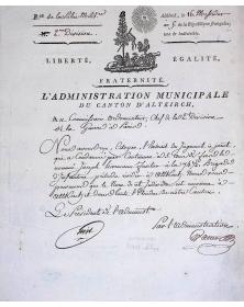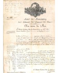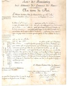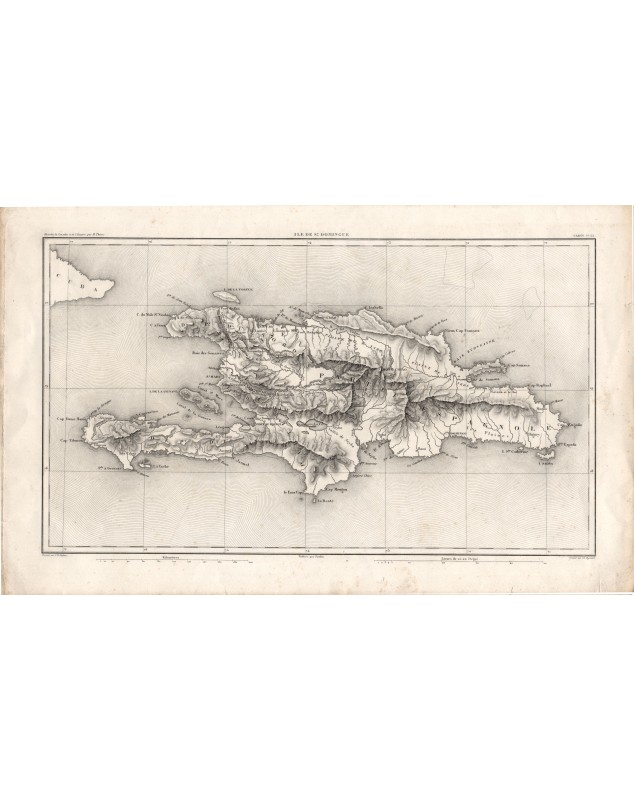
Ile de St-Domingue
Old map of the island of Santo Domingo, with North department and Spanish part, and on the upper left side, Island of Cuba.
In French
Issued from "Histoire du Consulat et de l'Empire" by M. Thiers (History of the Consulate and the Empire")
Size: 43x26 cm

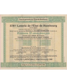

Ile de St-Domingue